Trail number
Six trails
Trail length
10 kilometres
Elevation variance
100 metres
Trail type
Single trail, fire trail
Trail surface
Smooth dirt, rocks and rock outcrops
Weather affected
All weather
Trail condition sources
Nil
Trail features
Views, summit cairn and snow gum forest.
Trail obstacles
Nothing major


Trail rating
Easy and Intermediate
Rating basis
Estimated
Night riding
Yes
Family Friendly
Younger MTBers could readily ride this course as long as they can climb reasonable gradients. Nothing too technical.
Click Image For Trail Map
No GPX download
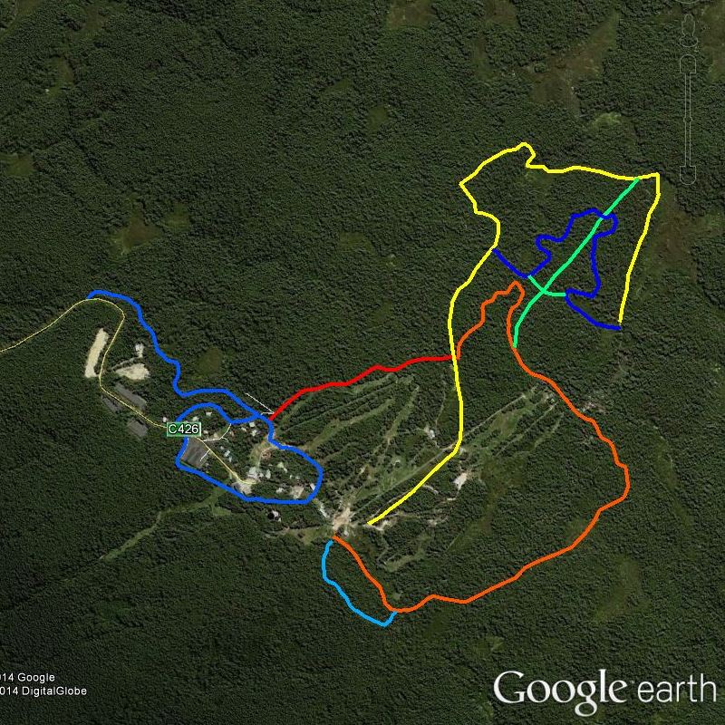
Mount Baw Baw has a series of cross country (XC) ski trails around the resort which are now being used as mountain bike trails in the summer season. There are about 10 kms of these trails plus two further trails being Muellers trail and one which appears to run from the National Park Junction back to the Summit Trail (green trail in above map). There are also a few side tracks adjacent to the Nordic trails which are also shown on the map which can be used by riders.
I haven't ridden these trails yet but have walked a number of them during the snow season and pictures of them are shown below to give an idea of what the trails are like. The trails are generally of an open fire trail type with surfaces varying from bark chips, dirt and granite outcrops. None of the trail surfaces are overly challenging technically with the trail ratings mainly based on the steepness of the trail.
All trails are very well marked both at intersections and along the route.
Note that the trails are only open between December and April each year. The pictures were taken in early June and there was heavy ice on the trails at the time so please respect the above trail restrictions for your own safety.
Please note mountain bikes are not allowed into the National Park (ie the trail to Mt St Gwinear).
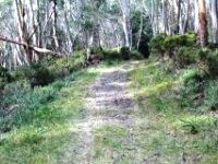
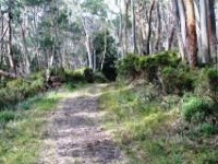
Below are some photos of the Summit Trail heading from the Skiosk near Tank Hill Run up to the Baw Baw summit and then across to Five Ways. After that I headed down Muellers Track which is shown on a separate page. The hills are not overly steep for mountain biking
 |
 |
 |
|---|---|---|
Heading up Summit Trail from near Magic Carpet area. |
||
 |
 |
 |
|---|
 |
 |
 |
|---|
 |
 |
 |
|---|
   |
|---|
Above is view northwards from the Summit Lookout and below is trail heading towards Muellers Track. Note rocky trail surface. |
 |
 |
 |
|---|
 |
 |
 |
|---|
 |
 |
 |
|---|
 |
 |
 |
|---|---|---|
Coming in to Muellers Trail. |
||
Below are some pictures of Beech Trail which is on the western side of the village. Beech Trail is an easy trail to ride on.
 |
 |
 |
|---|
 |
 |
 |
|---|
No video available for these trails.
 |
Parking is available at Mount Baw Baw village. |
|---|---|
 |
Toilet facilities are available in Mount Baw Baw village on Currajong Road at the information centre and near the toboggan run. |
 |
Drinking water is available in Mount Baw Baw village. |
 |
Food and drinks are available in Mount Baw Baw village. |
 |
Local area information can be obtained at the information centre on Currajong Avenue. |